How big is metropolitan France?
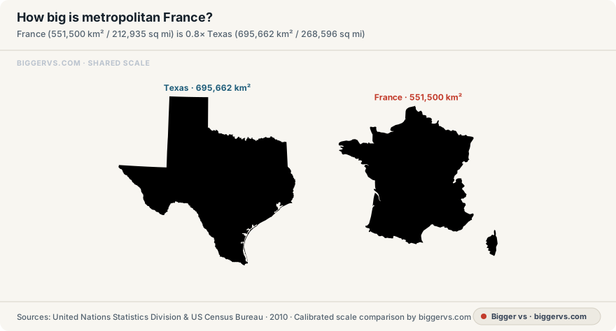
This metropolitan France outline uses UNData’s published surface-area figure of 551,500 km². The drawing includes Corsica and follows the geographic scope recorded in the library.
By Bigger vs · Published
France has 0.8× the published area of Texas. Each outline uses its own equal-area projection and is scaled to the area in the table.
- Texas
- 695,662 km² (268,596 sq mi)France area is 0.79× this area · Area · Filled area of the simplified 2017 Census outline, scaled to the published 2010 total.
- Germany
- 357,581 km² (138,063 sq mi)France area is 1.54× this area · Area · Filled area of an equal-area projected outline, calibrated to the adopted published area.
- Spain
- 506,008 km² (195,371 sq mi)France area is 1.09× this area · Area · Filled area of an equal-area projected outline, calibrated to the adopted published area.
Name the part of France being compared
This outline depicts metropolitan France with Corsica. France’s overseas departments and territories require their own outlines and an explicitly stated combined scope. When another reference gives a different national area, check the territorial coverage, definition and edition before comparing its number with the figure adopted here.
Compare the filled area of each map
The outlines use separate equal-area projections calibrated to the published figures. Their widths depend on their shapes. Texas can therefore have a different width ratio from its area ratio with France. Read the square-kilometre values and the filled regions together, especially when a narrow or elongated country looks visually large.
Changing map scale changes both dimensions
Double an outline’s width and height and its filled area becomes four times as large. To draw a map at a requested area ratio, its linear scale must follow the square root of that ratio. This is the relationship used by the size game and explains why map estimates have separate scale and area feedback.
Measurement and sources
- Adopted measurement
- 551,500 km² (212,935 sq mi) · Area
- Measurement basis
- Published measurement
- Scope
- Metropolitan France, including Corsica; excludes overseas departments and territories.
- Measured endpoints
- Filled area of an equal-area projected outline, calibrated to the adopted published area.
- Source edition and location
- UNData country profile / 2025 World Statistics Pocketbook; area reference year 2023 General information: Surface area (km²); footnotes: 2023
Read the complete measurement record · Inspect the illustration and measuring line · Open standalone SVG scale diagram
Source record checked . Guide reviewed .
Does this France outline include overseas territories?
The depicted scope is metropolitan France including Corsica. Overseas departments and territories are outside this outline. A combined French territory total requires a separate stated scope and source.